MapsRepo logo
  • World
    • World Map
    • Continents
    • Oceans
  • N. America
    • USA
    • Canada
    • Mexico
    • The Bahamas
    • Haiti
    • Cuba
    • Dominican Republic
    • El Salvador
    • Nicaragua
    • Guatemala
    • Honduras
    • Barbados
    • Costa Rica
    • Belize
    • Jamaica
    • Saint Lucia
    • Panama
  • S. America
    • Brazil
    • Colombia
    • Argentina
    • Venezuela
    • Peru
    • Bolivia
    • Chile
    • Ecuador
    • Paraguay
    • Uruguay
    • Guyana
    • Suriname
  • Africa
    • Nigeria
    • Egypt
    • Kenya
    • South Africa
    • Ethiopia
    • Algeria
    • DRC
    • Uganda
    • Tanzania
    • Sudan
    • Angola
    • Ghana
    • Côte d’Ivoire
    • Madagascar
    • Niger
    • Morocco
  • Europe
    • Russia
    • Germany
    • Italy
    • UK
    • France
    • Poland
    • Romania
    • Ukraine
    • Turkey
    • Spain
    • Sweden
    • Belgium
    • Czech Republic
    • Hungary
    • Greece
    • Portugal
    • Netherlands
  • Asia
    • China
    • Japan
    • Iran
    • India
    • Pakistan
    • Bangladesh
    • Philippines
    • Indonesia
    • Vietnam
    • Thailand
    • Afghanistan
    • Iraq
    • Yemen
    • Uzbekistan
    • South Korea
    • Myanmar
    • Malaysia
  • Oceania
    • Australia
    • New Zealand
    • Fiji
    • Papua New Guinea
    • Solomon Islands
    • Nauru
    • Vanuatu
    • Samoa
    • Palau
  • Upload Map

Your download is starting…

Your file should begin downloading automatically in a moment.

Map of Mozambique (JPG)
Nothing happenning? Click here to download manually
Back to map page Browse more maps

Related maps

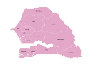
Labeled map of Senegal showing its 14 regions
View Map
Africa

Map of Senegal

Labeled map of Senegal showing all 14 regions. Available in JPG, PDF, or SVG under a Creative Commons license.

3 By MapsRepo
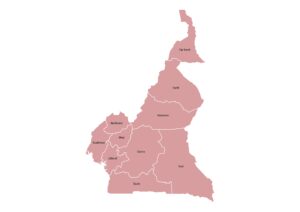
Labeled map of Cameroon showing its 10 regions
View Map
Africa

Map of Cameroon

Cameroon map showing all 10 regions with names. Download in JPG, PDF, or SVG under a Creative Commons license.

5 By MapsRepo
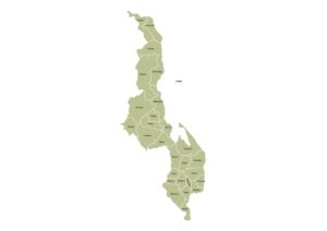
Labeled map of Malawi showing its 28 districts
View Map
Africa

Map of Malawi

Map of Malawi displaying all 28 districts, including Likoma Island, with names. Available in JPG, PDF, or SVG under a…

7 By MapsRepo
  • Upload Map
  • About Us
  • Contact Us
  • Privacy Policy
  • Terms of Use
  • Copyright Policy

© 2026 MapsRepo. Creative Commons License